When contacting me about a particular photo(s),
always refer to the Post Date, Photo Number and Description.
[Photo #1 is always at the top of the posting]
Remember to Left-Click any photo to open a larger view,
then hit the ESC (escape) button on your keyboard
to return to the BLOG
--------------------------------------------------------
In late October 2012, Hurricane Sandy decimated the Jersey Shore, some areas more than others, and left a path of destruction up and down eastern seaboard. The hardest hit areas were from Point Pleasant south to Seaside Heights, with the greatest loss of personal property and homes in the Lavallette, Ortley Beach and Mantaloking areas.
I was finally able to take advantage of some superb flying weather this past Thursday which provided Dad and I with CAVU, meaning Ceiling And Visibility Unlimited. We began our photo flight near the Keansburg, NJ area and over to Sandy Hook. From there we flew south along the entire Jersey Shore to Cape May airport where we refueled. Upon departing, we flew back north along the shoreline to Sandy Hook once again and west past Keansburg towards our home base airport in western New Jersey.
The pictures I shot show much detail with only a handful covering general areas from afar. From listening to news reports and TV coverage, it was hard for me to gauge just how bad the damage to the shore area really was, short of talking with folks who have actually been down there assessing damage to their own properties. This is why I needed to see it with my own eyes, and camera lens, then share these stunning yet sad views with all of you. One thing of interest to note is that the damage gets progressively less the further south you travel, where Sandy's Eye had made landfall near Atlantic City.
I have lived in New Jersey all of my life and enjoyed many day trips to the Jersey Shore while growing up, as well as numerous flights along this pristine length of shoreline. It's hard to see it in this condition, but at the same time, there are so many beach areas that have already been rebuilt, and this is in only a months time. A rebuilt and renewed Jersey Shore is coming, though time will tell just how long this will take.
The photos are organized into the following categories and arranged by towns/areas from north to south: Keansburg, Sandy Hook, Sea Bright to Brielle, Point Pleasant, Lavallette and Mantoloking, Seaside Heights, Island Beach State Park, Long Beach Island, Atlantic City and Margate and finally, Wildwood.
Ok then, let's begin our flight along the ever-changed Jersey Shore...
------------------------------------------------------------
Keansburg


------------------------------------------------------------
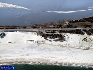
Sandy Hook
 |
| Work already being done on restoring the beach |
 |
| Sandy Hook National Park Entrance Plaza / Toll Booths |
 |
| Route 36 bridge and interchange show no signs of damage |
------------------------------------------------------------
Sea Bright south to Brielle, in no particular order
 |
| Manasquan Inlet |
 |
| Manasquan |
 |
| Manasquan |
 |
| The only thing left of the boardwalk are the supports |
 |
| Again, only the boardwalk supports are all that remain along nearly the entire Jersey Shore, from Sea Bright to Seaside Heights |
 |
| Ocean avenue bridge in Avon by the Sea is used as a car traffic barrier |
 |
| Ocean Grove's boardwalk partially survived |
 |
| Asbury Park |
 |
| Asbury Park |
 |
| Asbury Park |
 |
| Sea Bright |
 |
| Sea Bright |
 |
| Sea Bright |
 |
| Sea Bright |
 |
| Lake in Ocean Grove |
 |
| Rumson road bridge in Sea Bright |
 |
| Rumson road bridge in Sea Bright |

------------------------------------------------------------
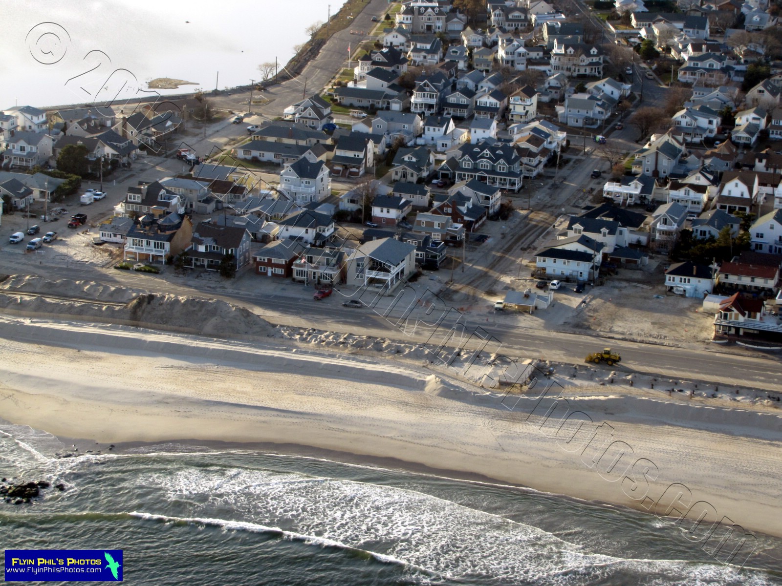
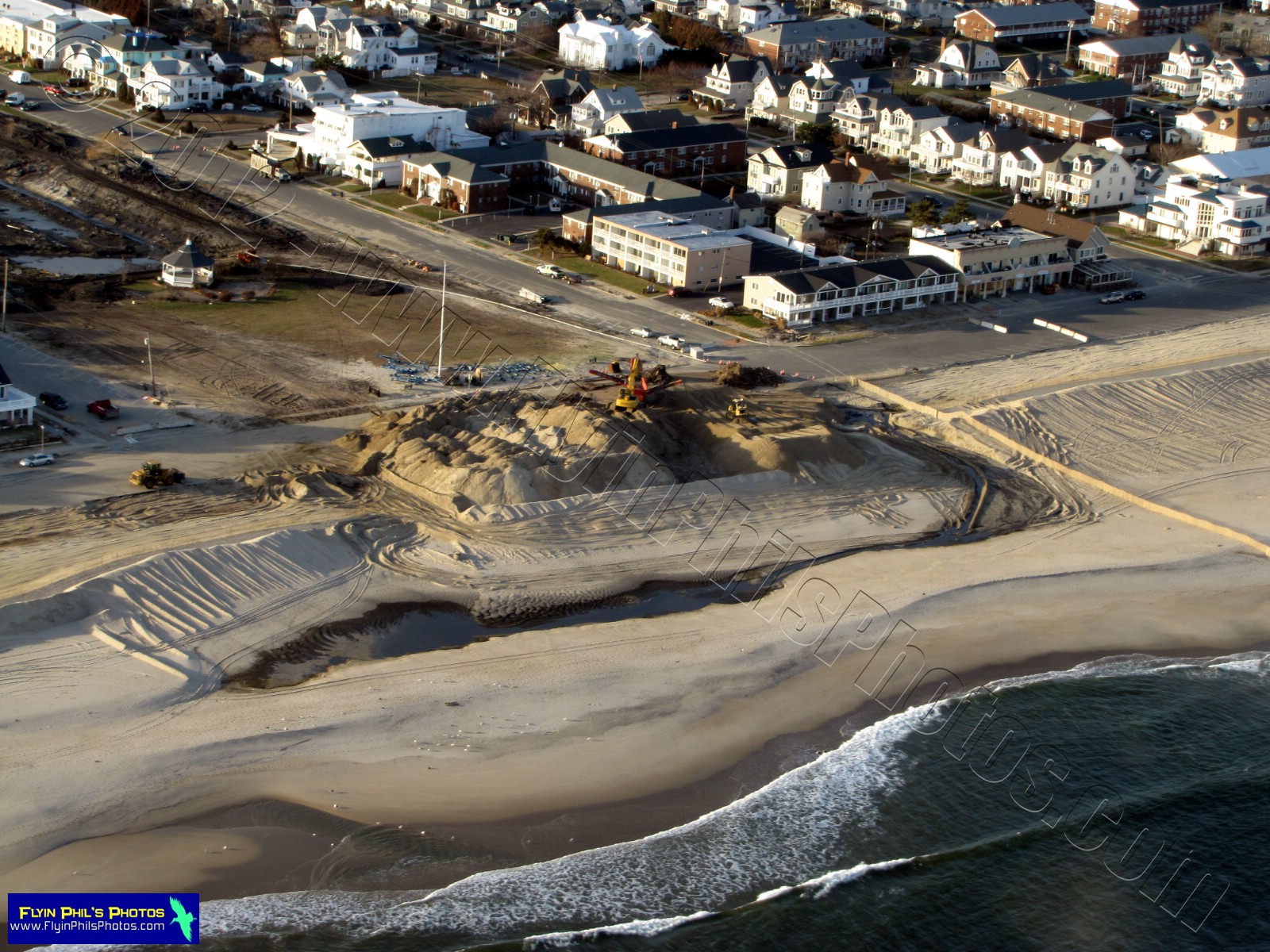
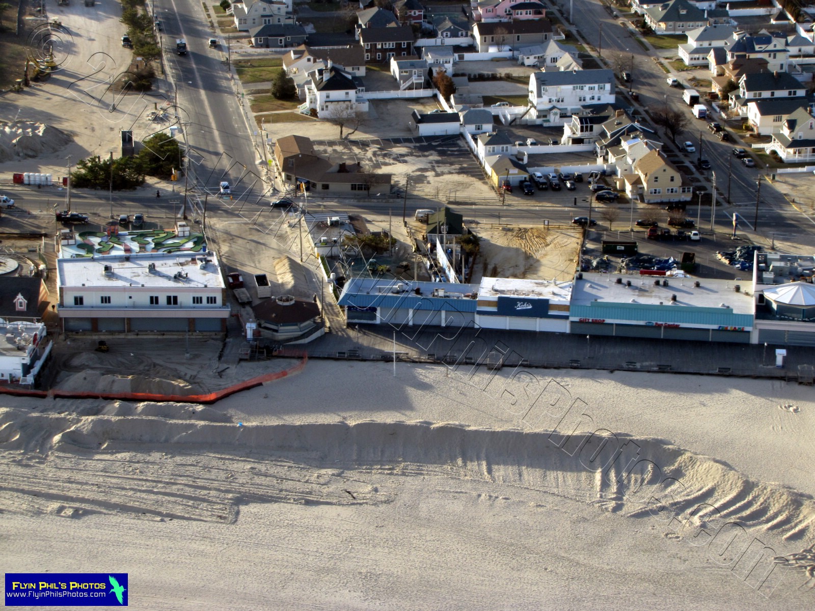
Point Pleasant
 |
| Jenkinson's Boardwalk |


------------------------------------------------------------
Mantoloking, Lavallette and Ortley Beach

 |
| This area, the Herbert street bridge in Mantoloking, is where the Ocean breached straight through to the Bay. Note how in only one month's time it has been almost fully repaired, minus the lost homes, of course. |
------------------------------------------------------------
The remainder of the photos from this area show the most significant damage to personal property along the entire Jersey Shore, and are difficult to look at without feeling sorry for so many folks who lost so much in such a short period of time...
 |
| No, this is not a house boat, but rather some poor souls home afloat, washed off its' foundation by Sandy |
 |
Some homes were completely destroyed and
practically unrecognizable as a home |
------------------------------------------------------------
Seaside Heights
 |
A length of boardwalk, or what's left of where it
once stood, between the now destroyed
Funtown Pier and the heavily damaged
Casino Pier. The only areas of boardwalk
that remain are nestled between
the arcade buildings. |
 |
Heavily damaged Casino Pier, with the
roller coaster than once sat on it now
resides in the Atlantic Ocean |
 |
Here you can see the Sky Ride that once carried
passengers along the northern end of the
boardwalk. Of course, as you can clearly see,
the boardwalk is no longer there. |

 |
Looking closely at all of these Seaside Heights
photos you will see that the majority of the
boardwalk has been unfortunately demolished by the surf. |
 |
Funtown Pier has been completely demolished,
with the exception of the Ferris Wheel, Drop Tower
and a few other larger rides that must have
had their own anchoring systems embedded deep
into the sand. Also note in the left-center of
the photo that the rear portion of the building
which houses the Carousel is completely destroyed. |
 |
An overall view of Seaside Heights
(Casino & Funtown piers), looking northeast |
 |
| Beach rental homes in Seaside Park |
 |
Some boardwalk areas in Seaside Park
miraculously survived |
 |
Note the looping coaster sitting in the ocean
as it leans on the destroyed Funtown Pier
|
 |
What a mess !!!
|
 |
Can you believe it that none of the
Boardwalk remains, except a few sections
between buildings |


------------------------------------------------------------
Island Beach State Park
 |
There's not much to show here except how
the sand dunes have been eroded into looking
like little islands with an ocean-facing cliff |
 |
The lifeguarded beach pavilions survived,
though much sand removal is needed |
 |
| A private residence is inundated with sand |
------------------------------------------------------------
Long Beach Island
 |
Like I mentioned, traveling further south
the damage becomes less visible from
the air, though I am sure there is evidence
of damage on close inspection from the ground. |


------------------------------------------------------------
Atlantic City and Margate
 |
No damage to show in Atlantic City,
though I still wanted to share a few
neat views of the area |
 |
This is an area of "artwork" still in
progress along the boardwalk |
 |
| Resorts casino and hotel |
 |
The Taj Mahal and Showboat
casinos, along with the newest
addition to Atlantic City, the Revel Resort |
 |
Lucy the Elephant in Margate
survived the storm |
------------------------------------------------------------
Wildwood
 |
And last but certainly not least is
Wildwood, which was spared any
significant damage from Sandy.
The amusement piers and boardwalk
are all in tact as far as one can
see from the air |
------------------------------------------------------------
Thanks for flying along, and let's keep
our fingers crossed for a speedy recovery
of our beloved Jersey Shore !!!