
When contacting me about a particular photo(s),
always refer to the Post Date, Photo Number and Description.
[Photo #1 is always at the top of the posting]
Remember to Left-Click any photo to open a larger view,
then hit the ESC (escape) button on your keyboard
to return to the BLOG
then hit the ESC (escape) button on your keyboard
to return to the BLOG
--------------------------------------------------------
Welcome to my Memorial Day 2011 flight, where all photos were
shot within the beautiful Garden State, namely New Jersey. The day was filled with a plethora of visual delights ranging from solar panel-covered parking lots to an uber-crowd packed Point Pleasant beach on the Jersey Shore.
As always, I hope you enjoy the view from above !!!
--------------------------------------------------------
 |
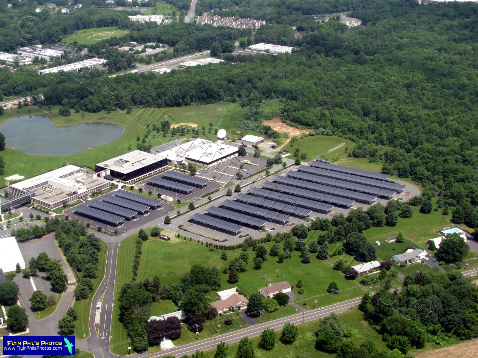
| #1 - Solar Panel-Covered parking lot of the Dow Jones newspaper publisher off Route 1 in Princeton |
 |
| #2 - Solar Panel-Covered parking lot of the Dow Jones newspaper publisher off Route 1 in Princeton |
 |
| #3 - Rowland Park-Field sports complex in South Brunswick Township, NJ |
 |
| #4 - Corporate office park in East Windsor |
 |
| #5 - New Jersey State Police in Cranbury, adjacent to the Jamesburg exit of the New Jersey Turnpike |
 |
| #6 - Homes I thought would look nice photographed |
 |
| #7 - Black Bear Lake Day Camp in Millstone |
 |
| #8 - Massive housing development east of the Garden State Parkway, south of Toms River |
--------------------------------------------------------
These next (2) photos feature Barnegat Bay-Front homes
 |
| #9 |
 |
| #10 |
--------------------------------------------------------
 |
| #11 - Homes in Point Pleasant on the Barnegat bay |
 |
| #12 - Wastewater Treatment Plant near Point Pleasant |
 |
| #13 - The Barnegat Bay, looking South at the Route 37 Bay Bridge |
 |
| #14 - Sloop Creek area on the western shore of the Barnegat Bay, southeast of Toms River |
 |
| #15 - The Jersey Shore, looking north from the entrance to Island Beach State Park |
 |
| #16 - Funtown Amusement Pier in Seaside Heights |
 |
| #17 - The Midway Steakhouse, midway of course, between Funtown & Casino piers in Seaside Heights |
 |
| #18 - Casino Amusement Pier in Seaside Heights |
 |
| #19 - Seaside Heights with its two amusement piers, Casino (left) and Funtown (right) |
 |
| #20 - Route 37 funneling traffic into the Seaside Heights area |
 |
| #21 - Brightwater Cottages in Lavallette |
 |
| #22 - Brightwater Cottages in Lavallette, looking southwest |
 |
| #23 - Parking lots are packed for the amusements area in Point Pleasant |
 |
| #24 - An Uber Crowd-Packed Jenkinsons in Point Pleasant Beach |
 |
| #25 - Looking south at the Manasquan Inlet and Point Pleasant. Note the Oregon Scientific ATC9K Action Cam attached to the wing strut. This is a mount I designed to shoot video of our take-offs and landings, as well as other areas of interest, all remotely from the cockpit. |
 |
| #26 - Manasquan Inlet and Point Pleasant (right) |
--------------------------------------------------------
The next (3) photos show Jenkinsons at Point Pleasant Beach
 |
| #27 |
 |
| #28 |
 |
| #29 |
--------------------------------------------------------
 |
| #30 - The Manasquan Inlet and Manasquan River flowing into it, headed for the Atlantic Ocean |
 |
| #31 - National Guard Training Center in Sea Girt, just north of the Manasquan Inlet |
 |
| #32 - Check-out this gem of a pool / entertainment complex, adjacent to a tree/shrub nursery |
 |
| #33 - The New Jersey Turnpike (looking South) with enormous distribution centers on either side |
 |
| #34 - A corporate office park and distribution centers sandwiched between the New Jersey Turnpike and State Route 130 near Jamesbury & Cranbury |
 |
| #35 - New home construction near Manville |
 |
| #36 - Another solar farm, this time in central NJ |
--------------------------------------------------------
What a flight...Dad and I never take for granted that we are able to
fly freely over the Garden State, and I can photograph such a vast
array of interesting sites, then share them with the world.
See you after the next flight....