When contacting me about a particular photo(s),
always refer to the Post Date, Photo Number and Description.
[Photo #1 is always at the top of the posting]
Remember to Left-Click any photo to open a larger view,
then hit the ESC (escape) button on your keyboard
to return to the BLOG
--------------------------------------------------------
--------------------------------------------------------
First, let's begin with a tour of central New Jersey and a slight detour into Pennsylvania. And as always, I hope you enjoy the view from above...
 |
#1 - Pipeline construction in
Hunterdon county to carry natural gas |
 |
#2 - Picturesque property on the
Sourland Mountain near Flemington |
 |
| #3 - School with Solar Panel-covered parking lots |
 |
| #4 - More solar panel-covered lots near Princeton |
 |
#5 - This architecturally pleasing corporate
layout is also near Princeton |
 |
#6 - Re-vamped New Jersey Turnpike
exit 8 (Route 33 and Hightstown) |
 |
#7 - Nitro coaster @ Six Flags
Great Adventure in Jackson |
 |
#8 - Opening weekend at Great Adventure
with a sparse parking lot @ 1 PM |
 |
#9 - Soon-to-be demolished Great Adventure
Safari toll plaza; The Safari will now be part
of your theme park admission, and
accessible from within the park itself
|
 |
#10 - New water slide construction
in Hurricane Harbor, adjacent
to the theme park |
 |
#11 - St. Alexander Nevsky Cathedral
in Lakewood |
 |
#12 - Lunch anyone?
McDonald's in Lakewood, NJ |
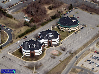 |
#13 - Three uniquely shaped buildings
in Brick Township |
 |
#14 - Housing developments afloat,
or so it looks like they are, in Brick Township |
 |
#15 - Intricate housing development canals
leading to the Barnegat Bay, in
Point Pleasant Beach near
the Mantaloking bridge |
 |
#16 - Mantaloking bridge (Route 528)
intersecting with Ocean avenue |
 |
#17 - During Hurricane Sandy, this is where
the Ocean breached straight through
to the Barnegat Bay |
 |
| #18 - Barren land in Bayville |
 |
#19 - This same barren land makes
for an interesting landscape |
 |
#20 - Water logged farm fields
near Lumberton |
 |
#21 - Massive greenhouse conglomeration
near Lumberton |
 |
| #22 - Flying 'W' airport in Lumberton |
 |
#23 - An unusual island with its own lake,
smack dab in the middle of the
Delaware river just west of Burlington |
 |
| #24 - Town of Bristol, Pennsylvania |
 |
#25 - Town of Bristol with the color
red prominent along the waterfront |
 |
#26 - Pennsylvania Turnpike and the
Bristol Bypass (looking west) |
 |
#27 - The former 3M airport (note the two
intersecting runways that are now roads),
in Levittown, Pennsylvania (looking west) |
 |
#28 - A massive storage lot for
Campers and RVs near
Fairless Hills, PA |
 |
| #29 - Train yard in Morrisville, PA |
---------------------------------------
The following (9) photos are of the
College of New Jersey in Trenton
 |
| #30 |
 |
| #31 |
 |
| #32 |
 |
#33
|
 |
| #34 |
 |
#35
|
 |
#36
|
 |
#37
|
 |
#38
|
---------------------------------------
The following (5) photos are of
Rider University in Lawrenceville, NJ
 |
#39
|
 |
#40
|
 |
#41
|
 |
#42
|
 |
#43
|
---------------------------------------
 |
#44 - The former Twin Pine airport
with its grass runway morphed
into sports fields |
 |
| #45 - Only the hangars remain at Twin Pine |
 |
#46 - Intersection of Routes 12, 31,
and 202 in Flemington |
 |
#47 - Liberty Village Premium Outlets
in Flemington |
 |
#48 - The train was running today
(upper-center of photo)
|
---------------------------------------
Next up are (10) photos of the city
of Trenton, NJ, and surrounding areas
 |
| #1 - Looking south |
 |
#2 - Looking south
|
 |
| #3 - Looking west |
 |
#4 - Looking west
|
 |
#5 - Looking north
|
 |
#6
|
 |
#7
|
 |
#8
|
 |
| #9 - New Jersey State House |
 |
#10 - New Jersey State House
|
---------------------------------------
And last but certainly not least is Seaside Heights with
its famous boardwalk and two amusement areas,
Casino and Funtown piers, which were
decimated in only a few short hours thanks to
Hurricane Sandy. Progress is being made in restoring
this summer vacation destination, though it will
take time as you will see below:
 |
| #1 - Casino pier (near) /Funtown pier (far) |
 |
#2 - Casino pier with coaster still
completely intact, sitting in the ocean |
 |
| #3 - Casino pier and coaster |
 |
#4 - Casino pier and lack of boards
along the famous boardwalk
|
 |
#5 - Lots happening in Seaside Heights
despite the conditions |
 |
#6
|
 |
#7 - Casino pier (top)
|
 |
| #8 - Casino pier and soon-to-be-rebuilt boardwalk |
 |
| #9 - Funtown pier was completely destroyed |
 |
#10 - Funtown pier
|
 |
#11 - Funtown pier (near) and
Casino pier (far)
|
 |
#12 - Notice the new boards being added
to the existing boardwalk pilings
|
 |
#13 - Mid-Way Steakhouse is
awaiting its boardwalk
|
 |
#14 - Pilings galore
|
 |
#15
|
 |
#16 - Overview of Seaside Heights beach
and amusement piers (looking southwest) |
 |
#17 - Completely decimated boardwalk
just north of Casino pier |
 |
#18 - Boardwalk (or lack there of) between
Casino and Funtown piers |
 |
#19 - Here's the coaster in tact
just sitting on the ocean floor |
 |
#20 - Most all of the rides have been
removed from Casino pier |
 |
#21 - Casino pier
|
 |
#22 - Overview of Casino pier
and adjacent water park |
---------------------------------------
See you after the Next Flight...
Happy Easter !!!