
When contacting me about a particular photo(s),
always refer to the Post Date, Photo Number and Description.
[Photo #1 is always at the top of the posting]
Remember to Left-Click any photo to open a larger view,
then hit the ESC (escape) button on your keyboard
to return to the BLOG
then hit the ESC (escape) button on your keyboard
to return to the BLOG
--------------------------------------------------------
It was a splendid day for flying and taking in the beauty
of the wintry terrain of northern and central New Jersey.
I hope you enjoy the many views I have captured
on this wintry, snow-covered day in the Garden State.
As always, I hope you've enjoyed the view from above !!!
---------------------------------------------------------
 |
| Round Valley reservoir (looking northeast) |
 |
| Route 31 midway between Flemington and Clinton |
 |
| Valley west of Sourland Mountain, looking northeast |
 |
| New Brunswick (looking northeast) with Manhattan and the new Freedom Tower poking its way up through the layer of grey smog |
 |
| Route 1 and the northeast corridor rail line south of New Brunswick |
---------------------------------------------------------
These next (3) photos show what Raceway Park
in Englishtown is used for vehicular storage during
the off-season...Notice the adjacent Old Bridge airport
 |


---------------------------------------------------------
 |
| A winding Delaware-Raritan canal paralleling River road, just north of Princeton |
 |
| The new Route 206 bypass in Hillsborough nearing completion |
 |
| Intricate and massive housing development in Hillsborough |
 |
| Endless farm fields (looking southwest) from Readington |
 |
| Campground at the east end of Round Valley reservoir near Clinton |
 |
| West end of Round Valley reservoir (looking southwest) near Clinton |
 |
| Custom Alloy corporation nestled in the hills of High Bridge |
---------------------------------------------------------
These next (5) photos are of Spruce Run reservoir
just north of Clinton. Notice the intricate and
unusual patterns that were formed in the icy surface.


This view is looking southeast
at Round Valley reservoir in
the far distance
---------------------------------------------------------
Windswept snowy fields near Stewartsville


---------------------------------------------------------
 |
| Architects Golf Club in Lopatcong (looking west) |
 |
| A wedge section of pines in the southwest corner of the Merrill Creek reservoir property |
 |
| Downed trees near Merrill Creek reservoir, remnants of hurricane Sandy's devastation |
---------------------------------------------------------
This section of Merrill Creek is a
Bald Eagle reservation, though now
it's devastated thanks to hurricane Sandy


---------------------------------------------------------
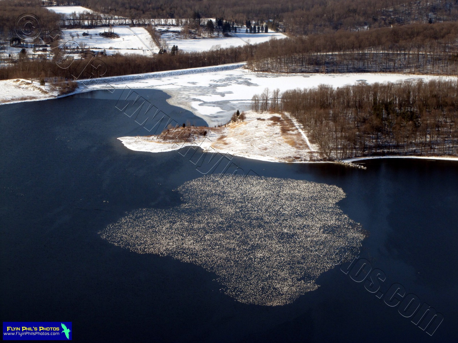
A massive flock of birds "floating"
over Merrill Creek reservoir

---------------------------------------------------------
 |
| Snow-covered corn maze near Hackettstown |
 |
| Washington (looking northwest) |
 | ||
| Washington center |
 |
| Neat building complex in Hackettstown |

 |
| M&M / Mars plant in Hackettstown with their adjacent Solar farm |
 |
| Massive townhouse complex east of Hackettstown |

 |
| The above two pictures show the transformation of the Netcong traffic circle into a massive, light signal-controlled intersection |
 |
| Corporation in Landing surrounded by solar panels |
 |
| High Bridge Hills Golf Course |
---------------------------------------------------------
These (4) photos are of Spruce Run reservoir
once again, with the last (2) showing
the close proximity to Round Valley Reservoir
in the distance (looking southeast)


---------------------------------------------------------
See you after the next flight...


